Typically, the words drone and airports are not ones you want in the same sentence. Airplanes and unmanned aircraft systems—or drones—don’t mix.
At the Port of Portland, we take airplane and passenger safety seriously—following all FAA guidelines closely when it comes to drones. We also recognize the valuable role they can play in our work.
The Port of Portland drone program started in 2016 with a simple mission: to explore the emerging technology and learn how it could be useful to our work. We began small—collecting data and imagery for applications in GIS (Geographical Information Systems) and to help us meet other requirements, like worker safety, through remote environment and asset inspection.
This year, we led our first drone flight at PDX in cooperation with our PDX airfield operations team. On the flight, we inspected trees for raptor nests—trying to spot the large birds that often use airport fields to hunt for prey, which is dangerous for the birds and the airplanes taking off and landing nearby.
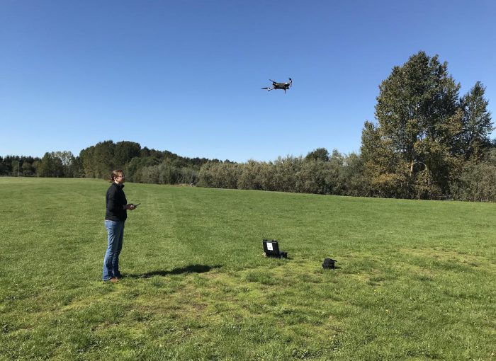
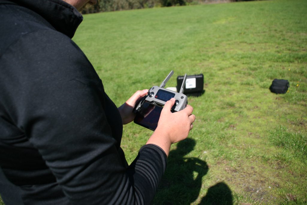
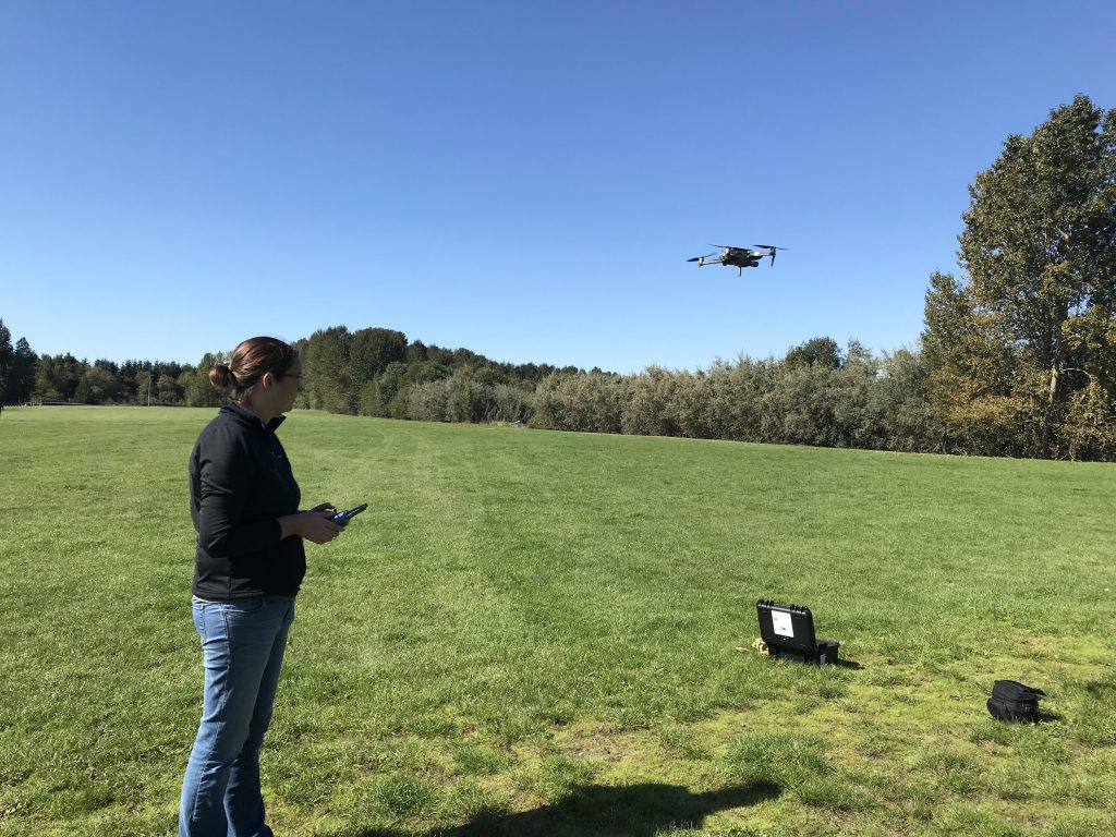
We caught up with Alice Pence, the GIS Analyst at the Port of Portland who piloted that flight, to learn what it takes to get a drone safely up in the air.
Piloting a drone … how cool! What was your career path to get there?
Alice: My background and passion has always been geosciences: geography, natural resources and geology. I earned a Bachelor of Science degree in Geography and Geographical Information Systems (GIS) in 2013, and I immediately began a career in the GIS analysis field. My first opportunity came as a GIS Intern for Ada County in Boise, Idaho—mapping out all the trail systems along the Greenbelt with a GPS unit and a small utility truck.
After my internship, I took a position at the Idaho Transportation Department as a GIS Analyst, where I designed and created an application for mobile data collection, which streamlined critical information-gathering for departments.
I took the next step in my career with the City of Auburn in Washington state. As a GIS and Database Specialist, my role with drones in the workplace really took off. I was trained by a retired Army UAV (unmanned aerial vehicle, or drone) pilot to set up missions, perform safety measures for a successful flight, and create outputs with the UAV imagery, which included 3D mapping, point clouds, elevation maps and videos. I took the FAA Part 107 test to become a certified drone pilot and recently completed the recertification to stay current with my license.
My GIS experience over the past 6+ years has helped me in my current role here at the Port by merging together all the different ways of data collection and spatial analysis. I’m now able to create successful outputs needed for various users throughout the Port.

Tell me a little more about how drones have benefited the Port’s work?
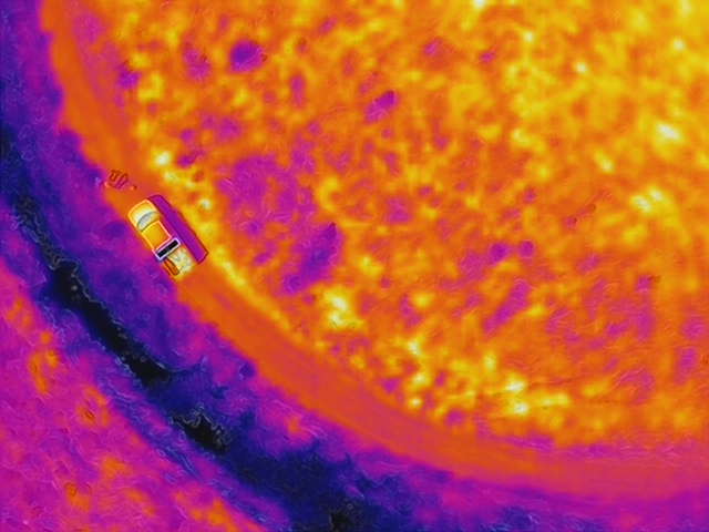
Alice: The Port is rapidly growing and changing; new land, new buildings, new roads, and with that comes the demand of getting current and updated aerial images for users throughout the Port. Yearly, we receive an updated aerial image provided from Metro. This aerial image service has great resolution, but this only comes once a year—and change is happening faster than that. With the introduction of drones, we can now get current aerial imagery at even higher resolution quickly to be able to capture the change for many different stakeholders. Plus, we can also support roof and structural inspections, thermal (heat loss or gain) inspections, and height and obstruction analysis.
The drones have also been able to capture the natural resource changes. Every season, the vegetation changes color and coverage, and water bodies change size and shape. Even habitat can change. With the drone, we can set up repeatable missions at the same locations to help us better mitigate for change or capture assets like vegetation type quickly, instead of viewing it all from an outdated source.
Did you have a specific interest in aviation or drones?
Alice: Since I can remember, I’ve always had a love for aviation and was fascinated with sectional maps aviators use for flying (I have a growing stack of old sectional maps in my home). Any opportunity for prime plane viewing and air shows, I’m there with my camera and plane identification app.
I’m also constantly seeking out air and space museums, drawn to the history and eager to learn about new horizons with advanced technology. My passion for aviation started when my mom gave me a poster of Buzz Aldrin on the moon with Neil Armstrong reflecting in his helmet. She had a work trip to Washington, D.C. and picked up the poster as a souvenir from the Smithsonian; she also gave me Astronaut Ice Cream (basically freeze-dried ice cream). From then on, I was hooked on anything space or flight related!
My passion for drones can be traced back to my dad. He has worked as a forester in Idaho his entire life. When I was growing up, I watched him use aerial photos for silviculture practices. He’d take these high-quality pictures from a low-flying aircraft, print them, and then use them to map out his land management plans. I remember looking at these photos, helping him mark out areas on the photo with a dry erase marker, and thinking how convenient—and totally cool—he could get the most current imagery for an area and map from it! Once I got into the field of GIS, and with the drone technology advanced to what it is now, I thought, here we go … just like how my dad used to do it. A perfect way to get current imagery, accurate spatial data and vital information out quickly to the stakeholders!
Your latest mission, to identify bird nests, took you through restricted airspace. What was that like?
Alice: The basic flight missions I previously completed had been standard automated missions with a set height and capture area and minimal obstacles. With this bird nest identification mission, all the rules changed. Now, I would be manually flying toward a tree, in restricted airspace, which was definitely something I have never attempted before and took me slightly out of my comfort zone. I also had to go beyond my personal flying rules and actually fly toward a tree instead of avoiding it. Overall, I was ready for the challenge and totally stoked to be able to fly within the PDX airfield, which had never been done before.
Air Traffic Control had to approve the UAV flight plan and remove restrictions that would allow us to fly within that area. Without that approval, the drones we operate would not take off, as the geo-positioning of the drone would show that it’s within restricted airspace. I received an “All Clear,” which meant my mission was approved and I was granted permission to fly within the airspace.
After getting all set up at the launch site, I started the steps to begin takeoff. When those blades started spinning I thought, this is by far the coolest thing I have ever done! I flew toward the tree but stayed within a distance that was comfortable to be able to view the nest clearly and accurately enough to gather all the data needed. I took a few pictures of the nest and some videos, then safely flew the drone back to the home point and landed it with no issues. When it landed, all the thoughts of what just happened hit me at once and I was so stoked that it all worked out.
How are you using those photos?
Alice: While the flight might seem like a quick, small mission, it played a huge part in the possibilities of what we can now do at the airport with the UAV.
These photos are being used for the wildlife team for them to be able to quickly view the nests that are in the trees surrounding the airport. The standard procedure right now is for the wildlife team to use their scopes and binoculars to view the nests in the trees to get an idea of which (or any) birds are nesting in them—and they still probably have to climb the tree to view it, which costs time and energy and puts staff at more risk. We can now launch the drone at safe distance, fly towards the nest in question, capture photos and videos and quickly understand what is there. And the wildlife team can then make the decision if they need to climb based on the high-quality photos and videos taken.